
Both the Fucino and L'Aquila basins are the source of devastating earthquakes with faults running parallel along the length of both basins and in the bordering Abruzzo-Appenine mountain range. The meeting commemorating the 100th anniversary of the Avezzano earthquake was located in Pescina, one of several cities destroyed by the 1915 earthquake (est. magnitude of between 6.8 and 7.0). The town still has not completely recovered.
 |
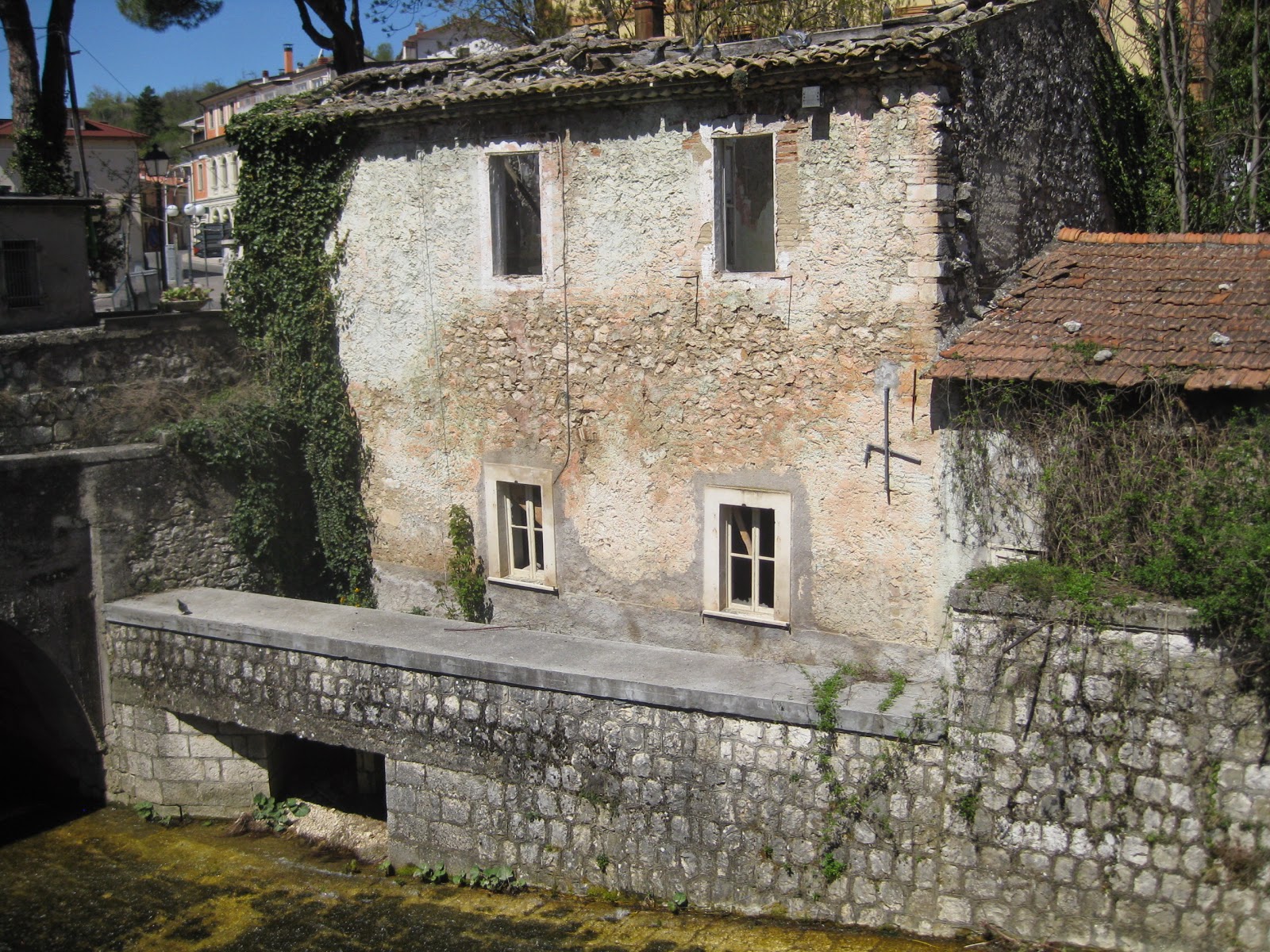
| abandoned dwellings in Pescina |
As well as extensive loss of life (estimated at 30,000 casualties), much cultural tradition and diversity disappeared in the wake of the catastrophe (Galadini, personal communication).
We were privileged to be shown one of the faults close-up and personal in a trench dug specifically for the field trip which culminated the workshop.
As a geophysicist used to working mainly with remotely sensed earthquake data (seismograms) and that of other geophysical phenomena, I am usually not able to 'see' the faults well in one of these (paleoseismic) trenches. Even when a patient and knowledgeable paleoseismologist points them out to me. In this case, the clear visibility of the fault structure (accompanied by lucid explanations from Paolo Galli and Fabrizio Galadini) was astounding and obvious, even to me.
 |
| Slip on a part of the San Benedetto dei Marsi fault, amazingly clear in this trench |
 |
| Panoramic view of the Fucino Basin |
The interesting and intensive field trip across both basins included a visit to L'Aquila, the site of the disastrous 2009, MW 6.3 (for publications: start here, for example and here) earthquake which occurred in the early morning hours on April 6, trapping many people in their beds. The earthquake will likely continue to remain notorious not only because of the tragic loss of life but also for the legal dilemma from the botched communications that ensued just prior to the earthquake.
 |
| Stitched photo of L'Aquila Basin from above |
Unfortunately, due to time constraints, we had to leave early and could not participate in the L'Aquila tour. But we made two quick side trips before making our way to Perugia, the next stop on our trip. The towns of Paganica and Onna received extensive damage from the 2009 L'Aquila earthquake. The parts of Paganica hardest hit are still in an abandoned state. Onna is a ghost town. Some visual reminders of the calamitous remains of the towns via pictures will be presented in the next post.
Photos: Klaus-G. Hinzen
No comments:
Post a Comment